What is total station in surveying?
TOTAL STATION TOTAL STATION Introduction This is an electronic tachometer, which consist of an electronic transit theodolite added electronic distance
Read moreSurveying or land surveying is the technique, profession, art and science of determining the terrestrial or three-dimensional positions of points and the distances and angles between them. A landsurveying professional is called a land surveyor.
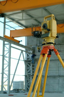
TOTAL STATION TOTAL STATION Introduction This is an electronic tachometer, which consist of an electronic transit theodolite added electronic distance
Read more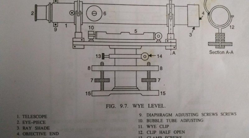
WYE Level ( Y Level ) in Levelling The difference between the dumpy level and the wye level ( Y
Read more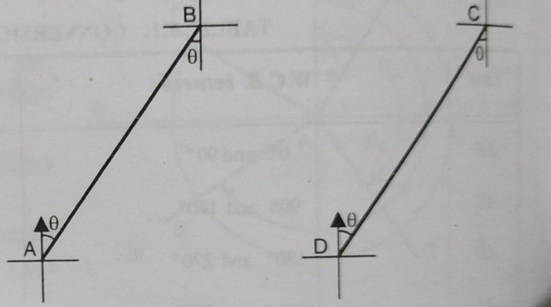
Do you know what is fore bearing and back bearing? In this post, we are going to discuss about the
Read more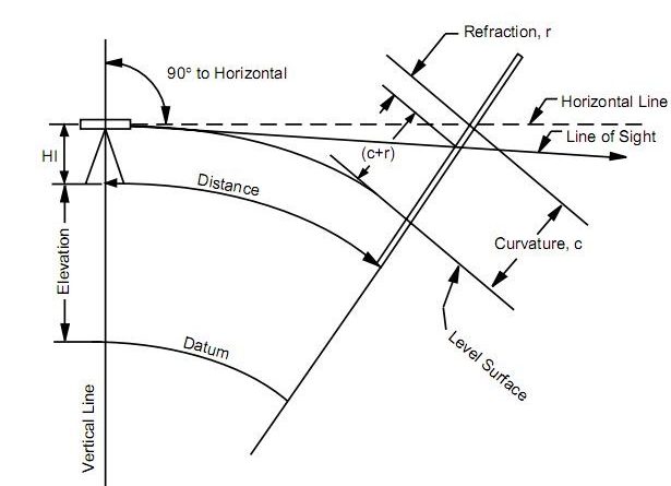
Types of Errors in Levelling- Instrumental, Natural and personal errors The main types of errors in levelling arise due to
Read more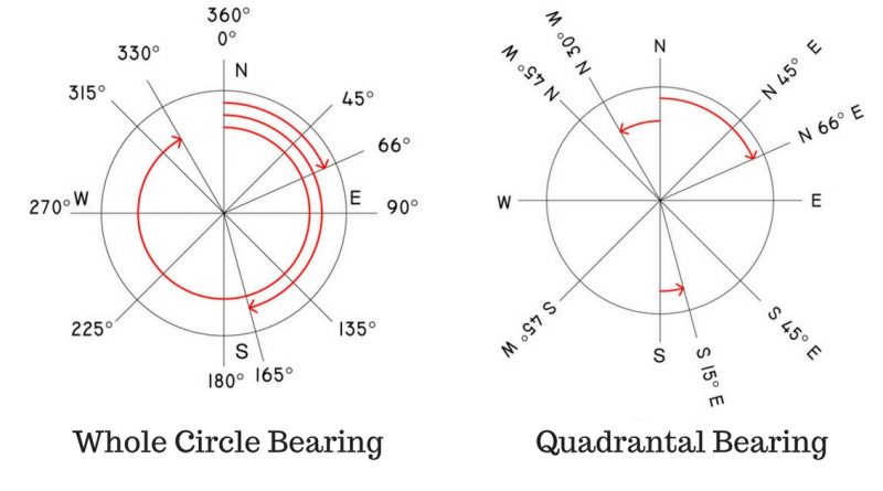
Bearing in surveying- Types and designation In this post, we are going to discuss about the bearing in surveying and
Read more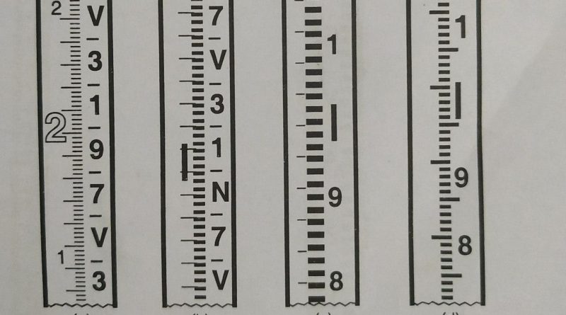
Types of Levelling Staff used in Surveying A levelling staff is a straight rectangular rod having graduations, the foot of
Read more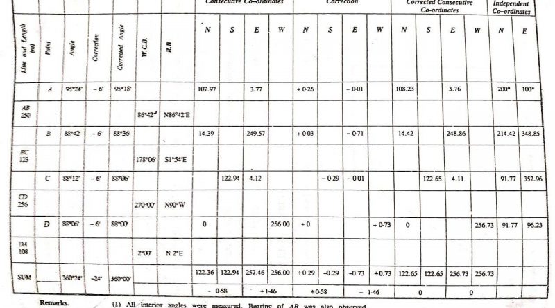
Gales Traverse Table-Definition, Procedure and Table Traverse computations are usually done in a tabular form, a more common form being
Read more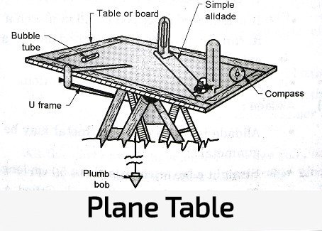
Advantages and disadvantages of plane table surveying In this article, we are going to discuss about the advantages and disadvantages
Read more
Most Common Errors in Plane Table Surveying In this article, we are going to discuss about some common errors in
Read more
A plane table surveying one of the widely used types of surveying. A plane table alidade is a straight edge
Read more
Orientation in plane table surveying is the process of putting the plane table into some fixed direction so that line
Read more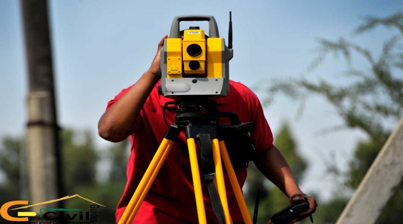
Important areas of application of levelling in surveying Applications For planning and estimating project works like roads, bridges, railways, airports,
Read more
What is Electronic Distance Measurement ( EDM )? The main instrument for surveyors on site today is the ‘total station’
Read more
What are the Errors in Taping | Taping in Surveying Methods of measuring with a tape have been dealt with,
Read more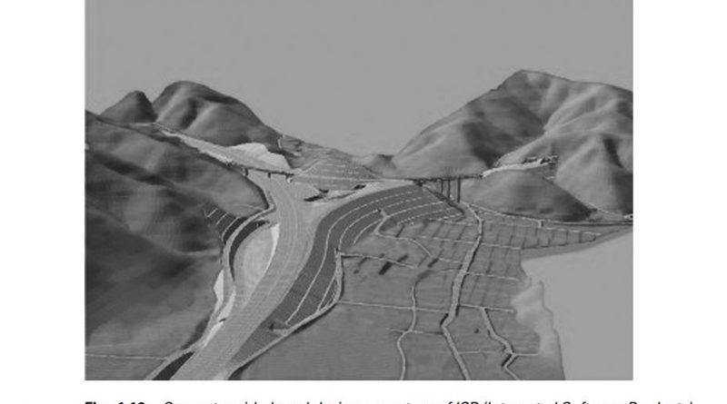
What is Computer Aided Design ( CAD) in Surveying ? In addition to the production of DGMs and contoured plans,
Read more