What is Digital Ground Model in Surveying ( DGM )?
What is Digital Ground Model in Surveying ( DGM )? A Digital Ground Model is a three-dimensional, mathematical representation of
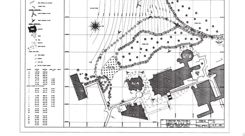
Read moreSurveying or land surveying is the technique, profession, art and science of determining the terrestrial or three-dimensional positions of points and the distances and angles between them. A landsurveying professional is called a land surveyor.
What is Digital Ground Model in Surveying ( DGM )? A Digital Ground Model is a three-dimensional, mathematical representation of
Read more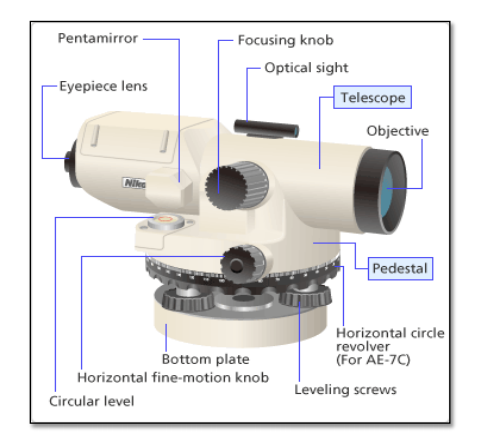
Levelling is used to find the height of one level relative to another. It is used to find the elevation
Read more
Digital Terrain Model A digital Terrain Model (DTM) is a numerical representation of the configuration of the terrain consisting of a
Read more
In this post, I am going to discuss the types of meridians in surveying. Surveying is a branch which is
Read more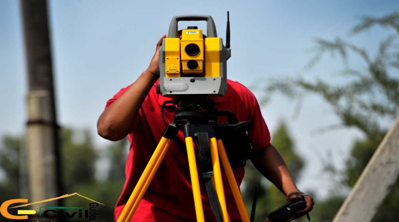
Uses of Surveying Some of the numerous functions of surveying are given below. Topographical maps showing hills, rivers, towns, villages,
Read more
The role of a Quantity Surveyor start from initial stage of the project.He prepares tender and contract documents including bills
Read more
Geodetic surveying is the survey in which the curvature of the earth is taken into account and higher degree of accuracy
Read more
Difference between Theodolite and Total station? Theodolite and Total Station are land surveying instruments used to get information about the
Read more
A total station can be used in a variety of ways during a survey. They are (these days) capable of:
Read more
Use of analytic lens in tacheometric surveying Tacheometry is a branch of angular surveying in which the horizontal and vertical
Read more
Advantages of the total station over levels Both have there place. I would not necessarily say that one replaced the
Read more
The purpose of Surveying is to accurately define your boundaries! Above and below the ground. Purpose of levelling in surveying
Read more
Traverse Surveying The type of survey which involves a number of connected survey lines and form a frame work is
Read more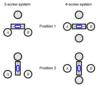
Theodolite is the main equipment for a surveyor.Theodolite is used for measuring horizontal, vertical and deflection angles.Before measuring these angles,
Read more
Theodolite is used for measuring the horizontal and vertical angles.Here we are going to learn about different transit theodolite parts.
Read more